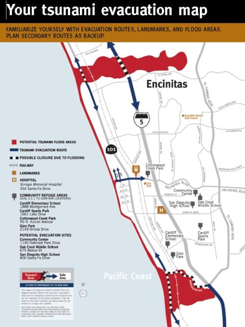
Encinitas Tsunami Facts, Preparedness And Evacuation Map
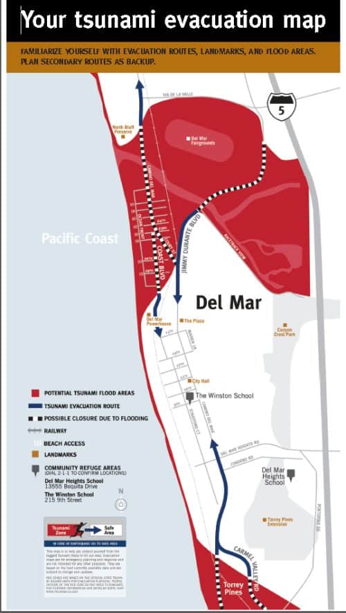
Tsunami evacuation maps for both Del Mar and Encinitas along with the expected flood zone are at the bottom of this page.
A Tsunami is a series of large traveling ocean waves of extremely long length generated by disturbances associated with earthquakes or massive landslides occurring below or near the ocean floor.
There are two sources of tsunamis: remote and local. Remote tsunamis have been the most frequent to hit California and are generated by earthquakes off the coasts of Japan, Alaska, Hawaii, and Chile.
The most significant remote tsunami to hit southern California was in 1960. An 8.6 magnitude earthquake off the coast of Chile generated a tsunami resulting in 4 foot waves at Santa Monica and Port Hueneme, and caused major damage to the Los Angeles and Long Beach harbors.
Local tsunamis are generated off the coast of Southern California. Since 1800, only four locally generated tsunamis have been observed. The most significant was in 1812 in Santa Barbara and Ventura County. Waves were reported at 6 to 10 feet high, and several small buildings were damaged and many ships were destroyed.
The Japan tsunami.
The Sumatra tsunami.
Del Mar Tsunami Facts, Preparedness And Evacuation Map
Encinitas Tsunami Facts, Preparedness And Evacuation Map